UNDERSTANDING LAKE WATER QUALITY GRADES
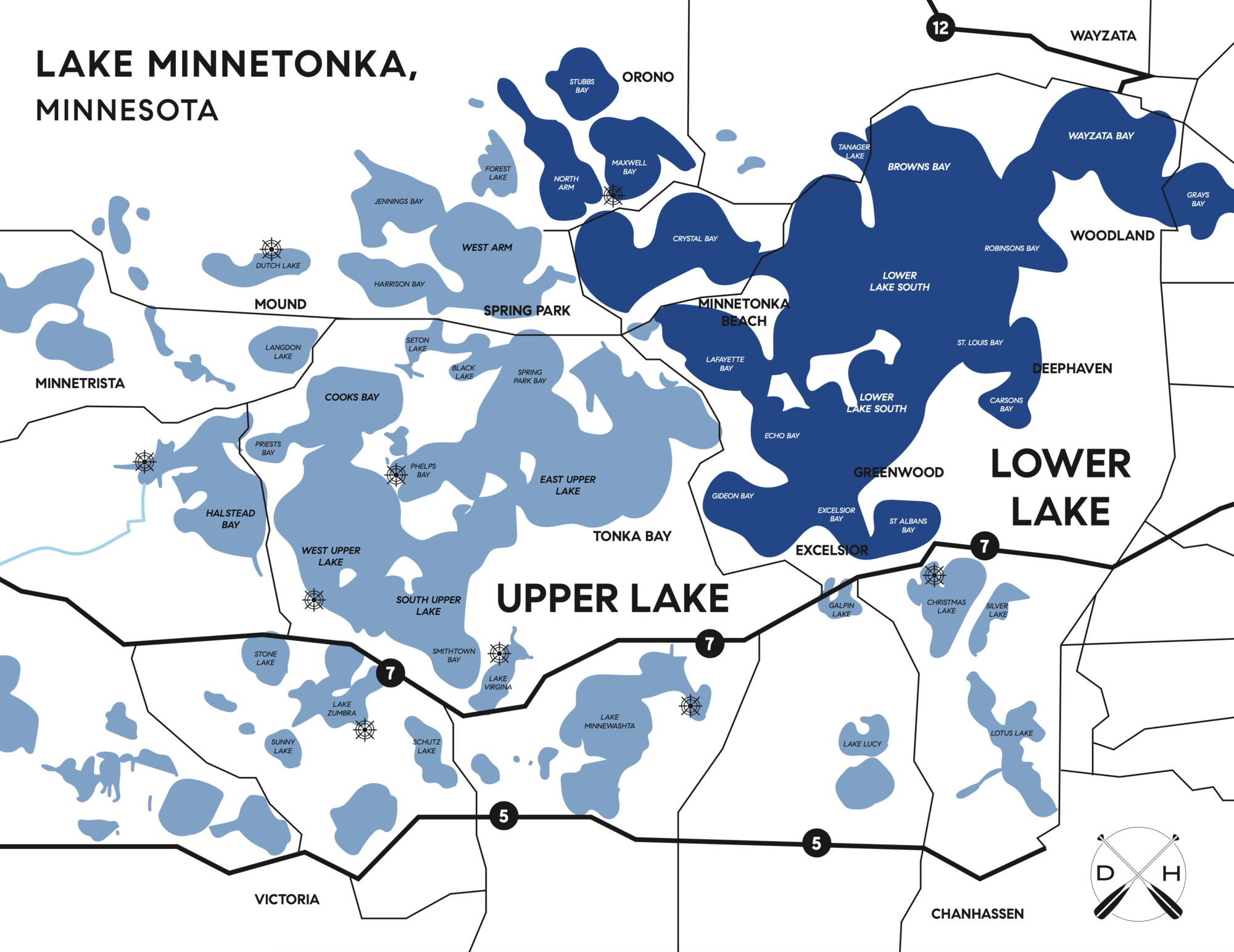
Lake Minnetonka is a unique body of water because each of the forty-two bays varies in depth, surface area, and water quality. The Minnehaha Creek Watershed District began its water quality grading method in 1989. Three factors combine to indicate the quality of the lake. However, additional factors include precipitation, aquatic plants, fisheries, harmful chemicals, and over-use to determine the lake's grade. The MCWD uses lake grades to compare waters in the same area.
THE 3 WATER QUALITY MEASUREMENTS:
- TP is the abbreviation of total phosphorus. Total phosphorus usually is a limited food source (nutrient) for algae and plants. An increase in total phosphorus relates closely to increased algae, frequency of algal blooms, and an increased quantity of blue-green algae.
- CHL-A is the abbreviation of chlorophyll-a. Chlorophyll-a is the green pigment in algae and plants essential to photosynthesis. A measure of chlorophyll-a in the water estimates the algal abundance.
- SD is the abbreviation of Secchi disk depth or water clarity. The lower the Secchi disk is visible, the clearer the water appears.
THE GRADE DISTRIBUTION IS BROKEN DOWN INTO LETTERS A-F:
- A: has a relative ranking of 90% and up clarity. Bays with this distinction are in the top 10% of the cleanest bays on Lake Minnetonka. They are often described as crystal clear and beautiful. Lakes with an A grade are exceptional and can be enjoyed recreationally without question or hesitation.
- B: has a relative ranking between 70-90% clarity. Described as generally good quality, but algae may limit swimming toward the end of the summer.
- C: has a relative ranking between 30-70% clarity. Described as average quality, where swimming, boating, and fishing may be undesirable relatively early in the season. Algae blooms occasionally in these bodies of water.
- D: has a relative ranking between 10-30% clarity. Described to have severe algae problems, where people are generally not interested in recreation on these lakes.
- F: has a relative ranking in the lowest 10% clarity. Bays with this distinction are in the lowest 10% of cleanest bays on Lake Minnetonka. Described as not enjoyable, lakes with this quality have severe limitations to recreational use.
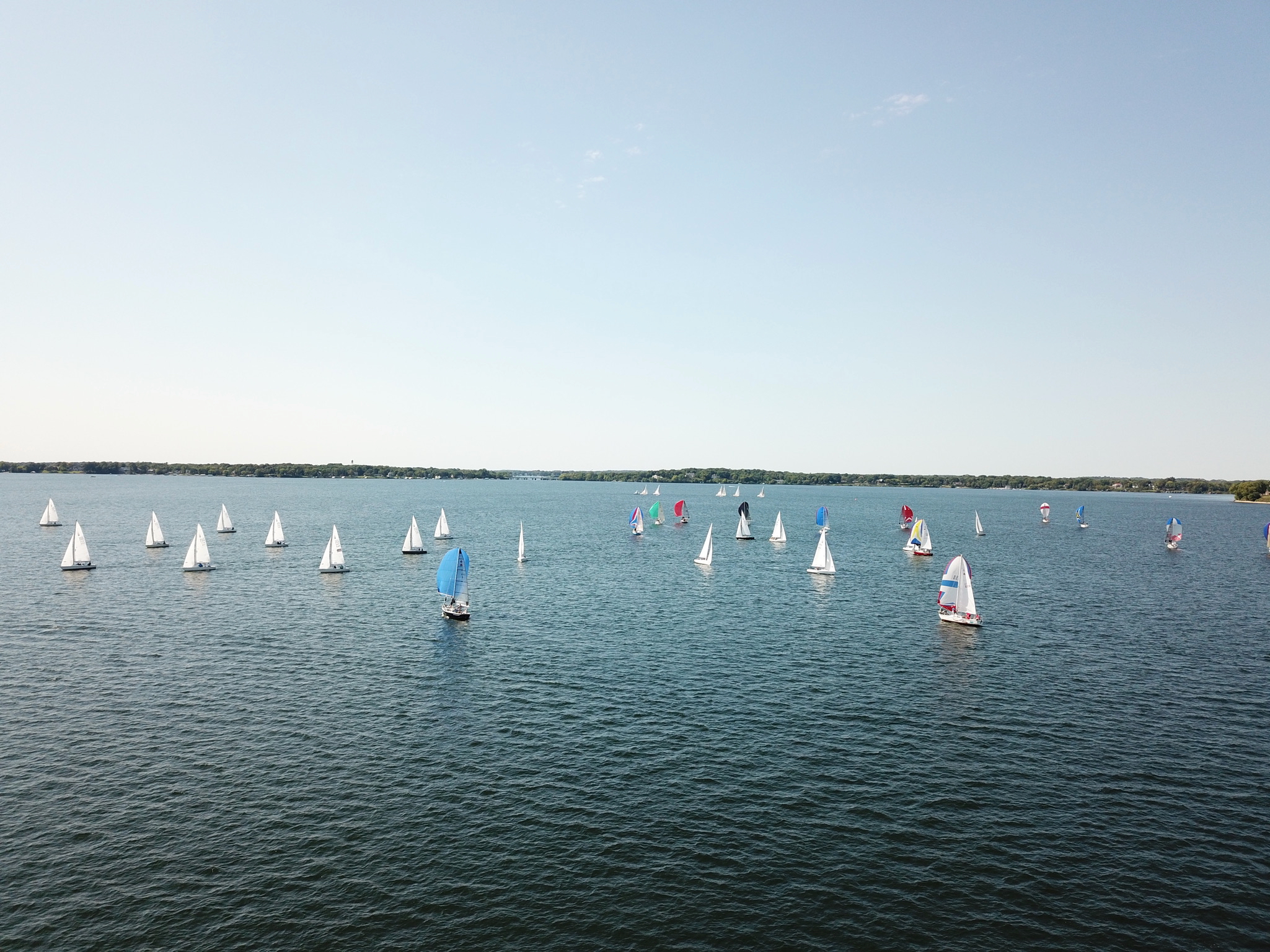
Explore below to learn more about the water quality in your favorite Lake Minnetonka Bay.
BLACK LAKE
The maximum water depth in Black Lake is 27 feet, with a C water quality rating determined by the Minnehaha Creek Watershed District.
BROWNS BAY
The water depth in Browns Bay ranges from 10 to 80 feet, with an A rating for water quality determined by the Minnehaha Creek Watershed District.
CARMAN BAY
Carman Bay has a maximum water depth of 20 feet, and the Minnehaha Creek Watershed District has classified the bay's water quality as an A. The water is crystal clear and can be enjoyed by recreational users at any time of the year. The city of Orono is actively working to keep Carman Bay clean by establishing the Carman Bay Lake Improvement District (CBLID), which works to improve water quality and target invasive species infiltrating the bay. This initiative has already seen results in reducing the number of invasive species in the bay while increasing the number of native species.
CARSONS BAY
Carsons Bay has a maximum water depth of 29 feet, and the Minnehaha Creek Watershed District determined the bay has an A in water quality.
COFFEE COVE
The Minnehaha Creek Watershed District determined Coffee Cove to have a C rating in water quality.
COOKS BAY
Cooks Bay has a maximum water depth of 43 feet, and the Minnehaha Creek Watershed District has determined the bay has a B rating in water quality.
CRYSTAL BAY
Allen French, an early settler, named Crystal Bay because of the crystal clear water that mirrors the sky above. The name stuck, and the Minnehaha Creek Watershed District reaffirms French's initial opinion and gives Crystal Bay an A in water quality. The bay has a maximum water depth of 113 feet, the deepest bay of Lake Minnetonka.
EAST UPPER LAKE
East Upper Lake has a maximum water depth of 48 feet, and the Minnehaha Creek Watershed District gives East Upper Lake a B in water quality.
ECHO BAY
The maximum water depth in Echo Bay is 20 feet, and the Minnehaha Creek Watershed District has determined the bay has an A in water quality.
EMERALD LAKE
The Minnehaha Creek Watershed District has determined Emerald Lake has a C in water quality.
EXCELSIOR BAY
The water depth in Excelsior Bay ranges from 4 to 35 feet, with an A rating for water quality, distinguished by the Minnehaha Creek Watershed District.
FOREST LAKE BAY
The maximum water depth is 30 feet in Forest Lake Bay, and the Minnehaha Creek Watershed District assigns the bay a C rating in water quality.
GIDEON BAY
Gideon Bay has a maximum water depth of 57 feet, and the Minnehaha Creek Watershed District has determined the bay has an A in water quality.
GRAYS BAY
The water depth in Grays Bay ranges anywhere from 5 to 30 feet, and the Minnehaha Creek Watershed District has determined it has an A rating for water quality.
HALSTEAD BAY
Halstead Bay has a maximum water depth of 36 feet, and the Minnehaha Creek Watershed District has determined it has a C rating for water quality.
HARRISONS BAY
The water depth of Harrisons Bay ranges between 4 to 30 feet, and the Minnehaha Creek Watershed District has determined the bay has a C rating for water quality.
JENNINGS BAY
Jennings Bay has a maximum water depth of 26 feet, and the Minnehaha Creek Watershed District has determined the bay has a C rating for water quality.
LAFAYETTE BAY
The water depth in Layfayette Bay ranges from 5 to 57 feet, with an A rating for water quality determined by the Minnehaha Creek Watershed District.
LIBBS LAKE
The water depth in Libbs Lake ranges from 2 to 8 feet, with a B rating for water quality determined by the Minnehaha Creek Watershed District.
LOST LAKE BAY
Lost Lake Bay has an abundance of cattails and reeds, which work to keep Lake Minnetonka clean by filtering the surface runoff. The maximum depth in the bay is only 3 feet, and the Minnehaha Creek Watershed District determined a C rating in water quality.
LOWER LAKE SOUTH
The water depth in Lower Lake South ranges from 5 to 80 feet, and the Minnehaha Creek Watershed District has determined the bay has an A rating of water quality.
MAXWELL BAY
The maximum water depth in Maxwell Bay is 43 feet, and the Minnehaha Creek Watershed District has determined Maxwell Bay has a B rating in water quality.
NORTH ARM BAY
The maximum water depth in North Arm Bay is 60 feet, and the Minnehaha Creek Watershed District determined North Arm Bay has a B rating in water quality.
NORTH LOWER LAKE EAST
The water depth in North Lower Lake East ranges from 12 to 51 feet, with an A rating of water quality determined by the Minnehaha Creek Watershed District.
NORTH LOWER LAKE WEST
The water depth in North Lower Lake West ranges from 10 to 80 feet, with an A rating water quality determined by the Minnehaha Creek Watershed District.
OLD CHANNEL BAY
The water depth in Old Channel Bay ranges from 5 to 51 feet, with a B rating for water quality determined by the Minnehaha Creek Watershed District.
PEAVY LAKE
The water depth in Peavy Lake reaches a maximum depth of 63 feet, and the Minnehaha Creek Watershed District has determined it has a C rating in water quality.
PHELPS BAY
The maximum water depth in Phelps Bay is 30 feet, with a B rating water quality determined by the Minnehaha Creek Watershed District.
PRIESTS BAY
The maximum water depth in Priests Bay is 46 feet, with a C rating water quality determined by the Minnehaha Creek Watershed District.
ROBINSON BAY
The maximum water depth in Robinson Bay is 70, and it has an A rating of water quality by the Minnehaha Creek Watershed District.
SETON LAKE
The maximum water depth of Seton Lake is 25 feet, with a C rating in water quality determined by the Minnehaha Creek Watershed District.
SMITHS BAY
The maximum water depth in Smiths Bay is 80 feet, with an A rating for water quality determined by the Minnehaha Creek Watershed District.
SMITHTOWN BAY
The maximum water depth in Smithtown Bay is 80 feet, and the bay has an A rating of water quality by the Minnehaha Creek Watershed District.
SOUTH UPPER LAKE
The maximum depth of South Upper Lake is 84 feet, with a B water quality rating determined by the Minnehaha Creek Watershed District.
SPRING PARK BAY
The maximum water depth of Spring Park Bay is 36 feet, with an A rating of water quality determined by the Minnehaha Creek Watershed District.
ST. ALBANS BAY
The maximum water depth of St. Albans Bay is 32 feet, with an A rating of water quality determined by the Minnehaha Creek Watershed District.
ST. LOUIS BAY
The maximum water depth of St. Louis Bay is 38 feet, with an A water quality determined by the Minnehaha Creek Watershed District.
STUBBS BAY
The maximum water depth of Stubbs Bay is 38 feet, with a C rating water quality determined by the Minnehaha Creek Watershed District.
TANAGER LAKE
The water depth in Tanager Lake reaches a maximum depth of 20 feet, and the Minnehaha Creek Watershed District has determined the bay to have a C rating in water quality.
WAYZATA BAY
The water depth in Wayzata Bay reaches a maximum depth of 87 feet, and the Minnehaha Creek Watershed District has determined the bay to have an A rating in water quality.
WEST ARM
The water depth in West Arm Bay reaches a maximum depth of 32 feet, and the Minnehaha Creek Watershed District has determined the bay to have a C rating in water quality.
WEST UPPER LAKE
The water depth in West Upper Lake reaches a maximum depth of 66 feet, and the Minnehaha Creek Watershed District has determined the bay to have a B rating in water quality.
IMPROVING LOW-WATER QUALITY LAKE GRADES
Raising a lake's grade requires additional work. It may mean changes to drainage patterns, filtration, or stormwater detention. And not all lakes have the same potential for improvement. For example, shallow lakes can have only so much Secchi disk visibility. Everyone plays a role in helping improve the water quality. For example, your home and yard may contribute to the poor quality of a neighborhood lake. Preventing pet waste, leaves, chemicals, and runoff from entering storm drains can help keep your lake or stream clean. The LMCD has a lakeshore owner guide answering frequently asked questions in aiding the transition to a lake-friendly lifestyle and cleaner lakes.
Source Minnehaha Creek Watershed District ®
Source Water Depth Map of Lake Minnetonka - Minnehaha Creek Watershed District ®

