
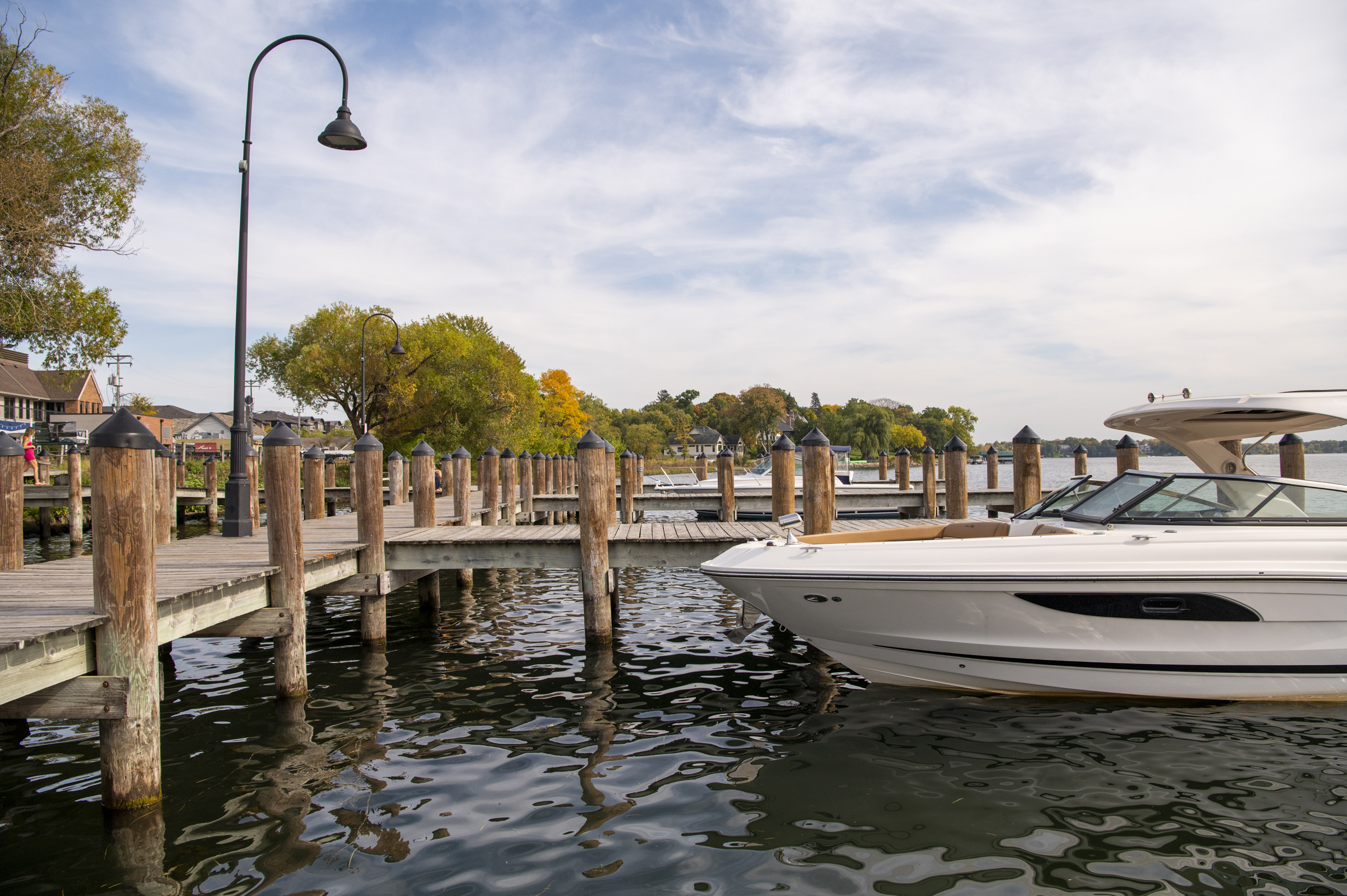
LAKE MINNETONKA DOCK REGULATIONS EXPLAINED
A dock can shape how a Lake Minnetonka property functions, but shoreline ownership does not automatically guarantee that every dock layout, boat lift, canopy, or number of watercraft will be allowed.
Dock rights on Lake Minnetonka depend on more than the amount of shoreline shown in a listing. The ordinary high water line, extended side property lines, water depth, lot history, adjacent navigation, existing approvals, and the size and placement of watercraft can all affect what is possible.
The Lake Minnetonka Conservation District, commonly called the LMCD, regulates docks, structures, and watercraft storage on the lake. Cities, the Minnesota Department of Natural Resources, the Minnehaha Creek Watershed District, and other agencies may also have authority over a proposed project.
This guide summarizes the major concepts buyers and lakeshore owners should understand. Because every shoreline is different, proposed improvements should be reviewed with the appropriate agencies before purchase, installation, or reconstruction.
LOCATION AND THE AUTHORIZED DOCK USE AREA
All docks, structures, moorings, stored watercraft, swim platforms, and related equipment must be located in an authorized Dock Use Area. The designated area is set by setbacks from extended side property lines and length into the lake.
- Locate the 929.4-foot ordinary high water line. LMCD measurements are based on the established ordinary high water elevation, not necessarily the visible water's edge on the day a property is measured.
- Extend the side property lines. Land-side boundary lines are projected into the lake to establish the side limits of the dock use area. Curved shorelines and irregular lots may require interpretation.
- Apply length and setback limits. The usable area is further shaped by dock-length standards, side setbacks, watercraft placement, canopy dimensions, neighboring access, and safe navigation.
A survey is often essential. A typical boundary survey may not show the LMCD ordinary high water line or extended lakeward property lines unless those items are specifically requested.
To learn more about designated dock use areas, including an illustration, dock length, and setback regulations, refer to the LMCD Residential Docks, Structures, and Watercraft pamphlet below.
DOCK LENGTH
As a general framework, allowable dock length is connected to the property's continuous shoreline measurement, subject to a maximum and several exceptions.
- On a typical residential shoreline, dock length may generally match shoreline frontage, up to 100 feet.
- On a qualifying site in existence before 02/05/1970 with 40 to 60 feet of shoreline, a dock length of up to 60 feet may be available.
- On a qualifying site in existence before 02/05/1970 with 40 feet or less of shoreline, the dock may be allowed to reach the first point of four-foot water depth, subject to a 60-foot maximum.
Length is not the only limitation. A dock that meets the general length standard may still be restricted by setbacks, navigation, water depth, environmental conditions, a prior variance, or the configuration of neighboring docks.
SETBACKS
Setbacks are generally measured from the extended side property lines. Different components of a dock system can trigger different standards.
- A dock extending 50 feet or less generally requires a 10-foot setback.
- A dock extending more than 50 feet and up to 100 feet generally requires a 15-foot setback.
- A qualifying older site with 50 feet or less of shoreline may be allowed a 5-foot setback, provided neighboring access is not impaired.
- Canopy fabric extending more than 30 inches vertically generally requires a 20-foot setback.
- A side-opening slip facing an adjacent property generally requires a setback equal to the slip depth, with a minimum of 20 feet.
In some circumstances, neighboring owners may agree to an encroachment or adjusted setback arrangement. Any such agreement should be documented and reviewed carefully because informal permission may not provide lasting, transferable rights.
DOCKS, DECKS, AND PLATFORMS
The LMCD follows the 1:50 feet Rule, allowing homeowners to store one watercraft per 50 feet of continuous shoreline on Lake Minnetonka. A site in existence on 08/30/1978 may generally qualify for two restricted watercraft, even when the 1:50 calculation would allow fewer.
Properties may have up to four watercraft if the following conditions are met:
- The property is a single-family residence that is legally subdivided and adjoined to shoreline property
- All dockage is exclusive use by the property's owner
- All restricted watercraft is owned and registered to the property owner
- The site meets all applicable code conditions or obtains a license to store five or more watercraft
Five or more restricted watercraft generally requires additional LMCD review and licensing. Not every small craft is counted the same way. Certain short, low-powered, nonmotorized, or human-powered craft may be excluded from the restricted-watercraft calculation when they are not stored on or above the water. Confirm the treatment of each craft with the LMCD.
For more information on residential dockage, refer to the LMCD page.
When looking to install dockage, make sure to follow these guidelines established by the Lake Minnetonka Conservation District.
- A dock, deck, or platform may exceed 8 feet in either length or width, but not both. An example of this would be owning a dock that is 8 ft x 10 ft but not 9 ft x 9 ft.
- Between the movement of a dock to another lake or waterbody, it must be left out to dry for 21 days to prevent the spread of invasive aquatic species.
BOAT LIFTS AND CANOPIES
- Boat lifts generally must fit inside the authorized Dock Use Area and comply with applicable setbacks and any property-specific variance or approval.
- An integrated fabric lift cover may receive different treatment from a canopy when its vertical fabric height does not exceed the applicable threshold. Taller fabric can trigger a larger setback.
PERMITS AND LICENSES
Generally, annual permits and licenses are not required for single-family homes. Permits and licenses are required in the situations listed below:
- A license is required to store five or more watercraft under certain circumstances allotted under the Code. Examples of residential properties allowed to dock five or more watercraft include properties with or sharing at least 226 feet of 929.4 OHW shoreline, homeowner associations, shared docks, etc.
- The installation of permanent docks using machine-driven pilings requires a permit.
- Dock extensions during Low Water Conditions require a permit.
- Permits have been required for nonconforming docks/moorings since 05/03/1978.
- Shared docks, associations, or multiple-owner facilities may require review.
- Practical difficulties caused by shallow water or overlapping dock use areas may require a variance.
- Material changes to an approved configuration may require review.
- Projects involving dredging, shoreline work, vegetation, or wetlands may require additional agency approval.
LMCD states that application review can range from approximately 30 days for some minor matters to 60 to 120 days for more complex requests. Public hearings, agency coordination, incomplete plans, or environmental review can extend the process. Begin review well before installation or closing.
CITY OF MOUND COMMONS DOCKS
Mound operates the largest municipally owned dock program in Minnesota, permitting up to 637 boats each year on Lake Minnetonka. Dock sites and slips sit on Commons land, and the program is administered by the City rather than the LMCD. Because sites are licensed annually rather than owned, a Mound dock is not a permanent property right, and it does not transfer automatically to a new owner at closing.
The single most important detail for buyers and sellers is the application calendar.
- Applications are accepted only between January 1 and the last day of February each year. The City states there are no exceptions to this window.
- Current dock and slip holders receive a renewal packet from the City at the end of each year.
- Applications must be submitted in person at Mound City Hall or postmarked through the US Post Office by the last day of February. Private postage meters are not accepted as proof of timely mailing.
- First-time applicants apply to the waitlist during the same January to February window.
Late applications are handled differently depending on the type of site:
- Non-abutting, or inland, resident dock sites: a late application means the participant loses their dock or slip site. The City allows a one-time exception for license holders who submit by March 15, with a $100 late fee in addition to the annual license fee.
- Abutting dock sites: a late application is subject to a $50 per month late fee.
- Waitlist applicants: a late application means losing your place on the waitlist.
The City specifically advises that residents purchasing and moving into a property that abuts a dock site should contact City Hall as soon as possible to complete their application and avoid a late fee. A closing that lands in the fall or early winter can put a new owner right up against the February deadline before they have unpacked, so this belongs on the closing checklist rather than the spring to-do list.
Buyers considering a Mound property should confirm with the City whether a dock site is attached to the address, whether it is abutting or non-abutting, whether the current license is in good standing, and where the property sits on the waitlist if no site is currently assigned. Marketing language referencing a dock is not the same as a licensed, active site.
CITY OF MOUND DOCKS & COMMONS PROGRAM
Questions about a specific site can go to the Mound Docks and Commons Program at City Hall, 2415 Wilshire Blvd, Mound, MN 55364, or 952-472-0600.
For more on how Commons land, direct access, and channel access differ as lakeshore types, see our guide to the types of lakeshore on Lake Minnetonka.
DOCK DUE DILIGENCE FOR BUYERS
A dock visible during a showing should not automatically be assumed to be legal, expandable, replaceable in the same configuration, or sufficient for the buyer's boats.
- Confirm the seller owns or has recorded rights to the shoreline.
- Obtain a survey showing the ordinary high water line and projected side lines.
- Measure continuous shoreline using the LMCD standard.
- Inventory every dock section, lift, canopy, slip, platform, and stored watercraft.
- Review recorded easements, licenses, variances, and neighboring agreements.
- Verify whether the current configuration is conforming or grandfathered.
- Determine whether the desired boats fit within the authorized Dock Use Area.
- Evaluate water depth, vegetation, wave exposure, navigation, and seasonal fluctuation.
- Confirm which agencies must approve future shoreline or dock work.
- Request written agency guidance when dock capability materially affects the purchase.
- In Mound, confirm the status of any Commons dock site and the next application deadline.
Dock utility can meaningfully affect lifestyle and resale value. Two properties with similar shoreline footage may support very different boat-storage and access configurations.
FREQUENTLY ASKED QUESTIONS
Can I assume the seller's existing dock is compliant?
No. A dock that has been in place for years may be nonconforming, may rely on a variance tied to specific conditions, or may never have been reviewed at all. Verify the configuration with the LMCD rather than relying on its presence.
Can I replace an old dock with a larger one?
Not necessarily. Replacing or enlarging a nonconforming dock can require the new structure to meet current standards, and a larger footprint may exceed length, setback, or Dock Use Area limits. Confirm before ordering materials.
Does shoreline footage shown in the MLS control dock rights?
No. Marketing figures are not the same as continuous shoreline measured at the 929.4 OHW line, which is the measurement the LMCD uses. A survey is the reliable source.
Does a neighbor's permission solve a setback issue?
Usually not on its own. Informal permission may not be binding on future owners and does not by itself waive a code requirement. Any encroachment or shared arrangement should be documented and reviewed with the LMCD.
Does a Mound Commons dock site come with the house?
Not automatically. Sites are licensed by the City on an annual basis, and applications are only accepted in January and February. A new owner should contact Mound City Hall as soon as possible after closing to complete an application and confirm the site's status.
Who should I contact before changing a dock?
Start with the LMCD, then check with your city, and, depending on the work, the Minnesota Department of Natural Resources and the Minnehaha Creek Watershed District. Projects involving dredging, shoreline alteration, or vegetation typically involve more than one agency.
KNOW WHAT YOUR SHORELINE CAN ACTUALLY DO
Dock capability is one of the hardest things to verify from a listing. Shoreline footage in the MLS is not the LMCD's measurement, a dock in a photo may be nonconforming, and a Mound address does not guarantee an active Commons site. These answers come from surveys, city records, and agency confirmation, not from a showing.
Dan has combed over every square inch of Lake Minnetonka in every season. Whether you are evaluating a property's dock potential before writing an offer, or working out how your shoreline and dock configuration affect what your home is worth, start with a conversation.

Meet Dan Hollerman
Specializing in the homes, lakeshore, lifestyle and history of Lake Minnetonka.
Source the Lake Minnetonka Conservation District®
Link to the 2026 Summer Safety Brochure.
Legal Disclaimer: The information provided on this page is for general educational and informational purposes only and should not be relied upon as legal, surveying, engineering, environmental, regulatory, title, or real estate advice. While Hollerman.com and Dan Hollerman make reasonable efforts to provide accurate and current information, no representation or warranty, express or implied, is made regarding the accuracy, completeness, timeliness, or applicability of the information to any particular property or situation. Dock regulations, permitting requirements, agency interpretations, water levels, shoreline conditions, easement rights, property boundaries, and applicable laws may change and may vary by property.
Any buyer, seller, or property owner should conduct their own independent due diligence and verify all information with the Lake Minnetonka Conservation District (LMCD), the applicable municipality, surveyor, attorney, engineer, and any other appropriate professionals before making any purchase, sale, construction, permitting, or investment decision.
Use of this website does not create a broker-client, agency, fiduciary, or advisory relationship with Dan Hollerman or Hollerman.com. To the fullest extent permitted by applicable law, Hollerman.com, Dan Hollerman, Compass, and their affiliates disclaim all liability for any loss, claim, damage, cost, or expense arising out of or related to the use of, or reliance upon, the information contained on this page. Hollerman.com and Dan Hollerman are not affiliated with, endorsed by, or acting on behalf of the LMCD, the City of Mound, or any governmental agency.